A6, A27

298.5 km, 3 h 45 min

Head west on Het Blauwgras80 m
Turn left onto Burgemeester Wuiteweg450 m
Enter the traffic circle and take the 1st exit onto Eikesingel20 m
Exit the traffic circle onto Eikesingel1 km
Enter the traffic circle and take the 3rd exit onto Zuiderhogeweg90 m
Exit the traffic circle onto Zuiderhogeweg550 m
Take the ramp on the right towards A7: Beetsterzwaag25 km
Keep left towards A6: Amsterdam20 km
Take exit 16 towards Bant4.5 km
Take exit 15 towards N351: De Munt3.5 km
Keep right towards Lelystad2.5 km
Take exit 14 towards Emmeloord-West45 km
Take exit 8 towards N702: Almere-Oostvaarders600 m
Enter the traffic circle and take the 2nd exit towards A6: Amsterdam60 m
Exit the traffic circle towards A6: Amsterdam3 km
Take the ramp on the left towards A27: Utrecht1.5 km
Continue onto A273.5 km
Take exit 37 towards Almere-Hout35 km
Take the ramp towards A28: Rijnsweerd800 m
Keep left towards A28: Ring Utrecht350 m
Keep left towards A27: Ring Utrecht20 km
Take exit 26 towards Lexmond25 km
Take exit 21 towards Hank20 km
Keep right towards A58: Antwerpen6 km
Keep left towards A16: Antwerpen1.5 km
Merge left onto A164.5 km
Continue onto E1935 km
Continue towards Ring Antwerpen: Gent15 km
Keep left onto E1715 km
Take the ramp towards N41: Dendermonde600 m
Keep right towards N16: Sint-Niklaas150 m
Continue towards N16: Sint-Niklaas500 m
Merge left onto Prins Alexanderlaan (N16)1.5 km
Take the ramp towards Lokeren250 m
Continue straight to stay on Prins Alexanderlaan (N16)35 m
Enter the traffic circle and take the 2nd exit onto Parklaan25 m
Exit the traffic circle onto Parklaan1 km
Continue onto Grote Markt250 m
Continue onto Parkstraat200 m
Make a U-turn and continue on Onze-Lieve-Vrouwplein150 m
Turn right onto Hemelaerstraat250 m
Enter the traffic circle and take the 1st exit onto Kroonmolenstraat10 m
Exit the traffic circle onto Kroonmolenstraat150 m
Turn right onto Dalstraat150 m
Turn left onto Kasteelstraat250 m
You have arrived at your destination, on the right0 m

A6, A27

316.3 km, 4 h 7 min

Head west on Het Blauwgras80 m
Turn left onto Burgemeester Wuiteweg450 m
Enter the traffic circle and take the 1st exit onto Eikesingel20 m
Exit the traffic circle onto Eikesingel1 km
Enter the traffic circle and take the 3rd exit onto Zuiderhogeweg90 m
Exit the traffic circle onto Zuiderhogeweg550 m
Take the ramp on the right towards A7: Beetsterzwaag25 km
Keep left towards A6: Amsterdam20 km
Take exit 16 towards Bant4.5 km
Take exit 15 towards N351: De Munt3.5 km
Keep right towards Lelystad2.5 km
Take exit 14 towards Emmeloord-West45 km
Take exit 8 towards N702: Almere-Oostvaarders600 m
Enter the traffic circle and take the 2nd exit towards A6: Amsterdam60 m
Exit the traffic circle towards A6: Amsterdam3 km
Take the ramp on the left towards A27: Utrecht1.5 km
Continue onto A273.5 km
Take exit 37 towards Almere-Hout35 km
Take the ramp towards A28: Rijnsweerd800 m
Keep left towards A28: Ring Utrecht350 m
Keep left towards A27: Ring Utrecht3 km
Take the ramp towards A12: Ring Utrecht800 m
Keep right towards A12: Ring Utrecht450 m
Keep left towards A12: Lage Weide700 m
Merge left onto A1235 km
Keep right towards A20: Hoek van Holland15 km
Take the ramp towards A16: Ring Rotterdam (oost)1.5 km
Continue onto A162 km
Keep left onto A166 km
Take the ramp towards A15: RING-Zuid700 m
Keep left towards RING A15: Rotterdam-Zuid600 m
Keep right towards A29: Rotterdam-Zuid800 m
Merge left onto A151.5 km
Take exit 19a on the left towards A29: Bergen op Zoom900 m
Keep left towards A29: Bergen op Zoom900 m
Continue onto A2925 km
Keep left towards A4: Vlissingen1.5 km
Continue onto A430 km
Continue onto Zeelandweg (A4)2 km
Keep right towards A4: Antwerpen7 km
Continue onto Havenweg (A12)8 km
Take the ramp towards Ring Antwerpen: Gent700 m
Continue onto R25.5 km
Merge left towards Laan 81.5 km
Continue onto Ploegweg1.5 km
Continue slightly right onto Ketenislaan550 m
Continue onto Steenlandlaan1.5 km
Take the ramp600 m
Continue onto R2800 m
Keep right towards Brugge600 m
Merge left onto E343.5 km
Take the ramp towards Sint-Gillis-Waas400 m
Turn left onto Verrebroekstraat (N451)250 m
Continue onto Provinciale Baan (N451)1.5 km
Continue onto Nieuwe Baan (N451)450 m
Continue onto Grote Kerkstraat (N451)1.5 km
Continue onto Vrasenestraat (N451)2 km
Continue onto Pastorijstraat (N451)300 m
Continue onto Turkyen (N451)800 m
Continue onto Huis ten Halven (N451)250 m
Continue onto Klapperbeekstraat (N451)700 m
Continue onto Vijfstraten (N451)900 m
Turn right onto Singel (R42)200 m
Enter the traffic circle and take the 1st exit onto Stationstunnel (R42)30 m
Exit the traffic circle onto Stationstunnel (R42)600 m
Continue onto Kleine Laan (R42)100 m
Enter Kleine Laan and take the 2nd exit onto Kleine Laan (R42)45 m
Exit the traffic circle onto Kleine Laan (R42)80 m
Enter the traffic circle and take the 1st exit onto Spoorweglaan15 m
Exit the traffic circle onto Spoorweglaan500 m
Make a slight left onto Westerlaan250 m
Continue slightly left onto Aerschotstraat150 m
Turn left onto Rolliersstraat200 m
Turn left onto Kasteelstraat15 m
You have arrived at your destination, on the right0 m
From
    To

      Distance: 157.47 mi (253.42 km)

      Driving route: 185.46 mi (298.46 km)

      Driving time: 3h 44 minutes

      Distance from Drachten to Sint-Niklaas

      The shortest distance (air line) between Drachten and Sint-Niklaas is 157.47 mi (253.42 km).

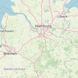
      The shortest route between Drachten and Sint-Niklaas is 185.46 mi (298.46 km) according to the route planner. The driving time is approx. 3 h 44 m.

      How far is Drachten from Sint-Niklaas

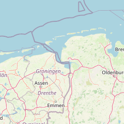
      Drachten is located in Zuidoost-Friesland, Netherlands within 53° 6' 0" N 6° 5' 60" E (53.1000, 6.1000) coordinates. The local time in Drachten is 22:01 (09.03.2025)

      Sint-Niklaas is located in Arr. Sint-Niklaas, Belgium within 51° 10' 0.12" N 4° 7' 59.88" E (51.1667, 4.1333) coordinates. The local time in Sint-Niklaas is 22:01 (09.03.2025)

      The calculated flying distance from Sint-Niklaas to Sint-Niklaas is 157.47 miles which is equal to 253.42 km.

      If you want to go by car, the driving driving distance between Drachten and Sint-Niklaas is 185.46 miles (298.46 km). If you ride your car with an average speed of 112 km/h (70 miles/h), travel time will be 2 hours 40 minutes. Please check the avg. speed travel time on the right for various options.

      Estimated Travel Time Between Drachten and Sint-Niklaas

      Average speedTravel Time
      30 mph (48 km/h)6 hours 11 minutes
      40 mph (64 km/h)4 hours 38 minutes
      50 mph (80 km/h)3 hours 43 minutes
      60 mph (67 km/h)3 hours 5 minutes
      70 mph (112 km/h)2 hours 39 minutes
      75 mph (120 km/h)2 hours 28 minutes

      Drachten, Zuidoost-Friesland, Netherlands

      Related Distances from Drachten

      CitiesDistance
      Drachten to Leeuwarden14.83 mi (23.87 km)
      Drachten to Groningen20.95 mi (33.71 km)
      Drachten to Zwolle40.30 mi (64.86 km)
      Drachten to Apeldoorn61.29 mi (98.63 km)
      Drachten to Almere62.71 mi (100.92 km)
      Drachten to Enschede69.63 mi (112.06 km)
      Drachten to Zaanstad70.39 mi (113.28 km)
      Drachten to Amsterdam71.21 mi (114.61 km)
      Drachten to Amersfoort72.19 mi (116.18 km)
      Drachten to Arnhem77.54 mi (124.79 km)
      Drachten to Haarlem78.84 mi (126.88 km)
      Drachten to Hoofddorp80.56 mi (129.65 km)
      Drachten to Utrecht81.47 mi (131.12 km)
      Drachten to Nijmegen87.11 mi (140.20 km)
      Drachten to Alphen aan den Rijn89.87 mi (144.62 km)
      Drachten to Leiden93.68 mi (150.76 km)
      Drachten to Zoetermeer98.02 mi (157.75 km)
      Drachten to The Hague103.01 mi (165.78 km)
      Drachten to s-Hertogenbosch103.53 mi (166.62 km)
      Drachten to Rotterdam105.88 mi (170.40 km)
      Drachten to Dordrecht108.18 mi (174.10 km)
      Drachten to Tilburg115.38 mi (185.68 km)
      Drachten to Eindhoven118.07 mi (190.02 km)
      Drachten to Breda118.42 mi (190.58 km)
      Drachten to Maastricht156.47 mi (251.81 km)

      Sint-Niklaas, Arr. Sint-Niklaas, Belgium

      Related Distances to Sint-Niklaas

      CitiesDistance
      Hoboken to Sint-Niklaas10.11 mi (16.27 km)
      Wilrijk to Sint-Niklaas10.83 mi (17.43 km)
      Antwerp to Sint-Niklaas12.09 mi (19.45 km)
      Berchem to Sint-Niklaas12.33 mi (19.84 km)
      Borgerhout to Sint-Niklaas13.67 mi (22.00 km)
      Merksem to Sint-Niklaas14.34 mi (23.07 km)
      Deurne to Sint-Niklaas14.81 mi (23.83 km)
      Mechelen to Sint-Niklaas17.87 mi (28.75 km)
      Gent to Sint-Niklaas19.35 mi (31.14 km)
      Vilvoorde to Sint-Niklaas20.78 mi (33.44 km)
      Laeken to Sint-Niklaas22.18 mi (35.70 km)
      Jette to Sint-Niklaas22.48 mi (36.17 km)
      Koekelberg to Sint-Niklaas22.48 mi (36.17 km)
      Moortebeek to Sint-Niklaas23.33 mi (37.55 km)
      Evere to Sint-Niklaas23.75 mi (38.22 km)
      Brussels to Sint-Niklaas24.08 mi (38.75 km)
      Sint-Joost-ten-Node to Sint-Niklaas24.43 mi (39.32 km)
      Anderlecht to Sint-Niklaas24.62 mi (39.63 km)
      Etterbeek to Sint-Niklaas25.47 mi (40.99 km)
      Forest to Sint-Niklaas25.81 mi (41.54 km)
      Leuven to Sint-Niklaas31.46 mi (50.64 km)
      Bruges to Sint-Niklaas39.48 mi (63.53 km)
      Charleroi to Sint-Niklaas54.57 mi (87.82 km)
      Namur to Sint-Niklaas58.00 mi (93.34 km)
      Liege to Sint-Niklaas72.44 mi (116.58 km)