

Distance from East Ham to Saint-Martin-Boulogne
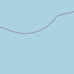
The shortest distance (air line) between East Ham and Saint-Martin-Boulogne is 88.20 mi (141.94 km).
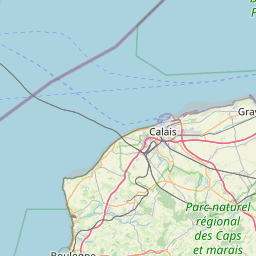
The shortest route between East Ham and Saint-Martin-Boulogne is 123.89 mi (199.38 km) according to the route planner. The driving time is approx. 2 h 26 m.
How far is East Ham from Saint-Martin-Boulogne
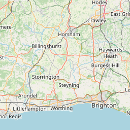
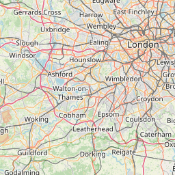
East Ham is located in Hackney and Newham, United Kingdom within 51° 31' 56.28" N 0° 3' 19.44" E (51.5323, 0.0554) coordinates. The local time in East Ham is 22:57 (05.03.2025)
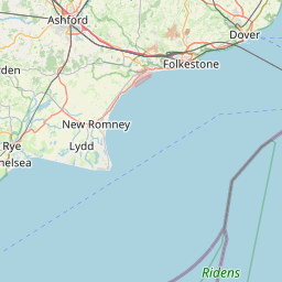
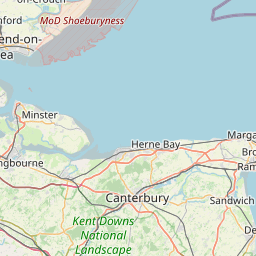
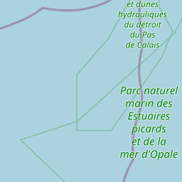
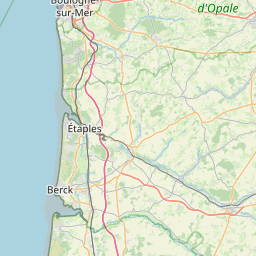
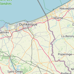
Saint-Martin-Boulogne is located in Pas-de-Calais, France within 50° 43' 32.88" N 1° 37' 55.92" E (50.7258, 1.6322) coordinates. The local time in Saint-Martin-Boulogne is 23:57 (05.03.2025)
The calculated flying distance from Saint-Martin-Boulogne to Saint-Martin-Boulogne is 88.20 miles which is equal to 141.94 km.
If you want to go by car, the driving driving distance between East Ham and Saint-Martin-Boulogne is 123.89 miles (199.38 km). If you ride your car with an average speed of 112 km/h (70 miles/h), travel time will be 1 hours 47 minutes. Please check the avg. speed travel time on the right for various options.
Estimated Travel Time Between East Ham and Saint-Martin-Boulogne
| Average speed | Travel Time |
|---|---|
| 30 mph (48 km/h) | 4 hours 8 minutes |
| 40 mph (64 km/h) | 3 hours 6 minutes |
| 50 mph (80 km/h) | 2 hours 29 minutes |
| 60 mph (67 km/h) | 2 hours 4 minutes |
| 70 mph (112 km/h) | 1 hours 46 minutes |
| 75 mph (120 km/h) | 1 hours 39 minutes |
East Ham, Hackney and Newham, United Kingdom
Related Distances from East Ham
| Cities | Distance |
|---|---|
| East Ham to London | 8.05 mi (12.96 km) |
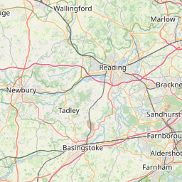
| East Ham to Reading | 44.57 mi (71.73 km) |
| East Ham to Worthing | 52.92 mi (85.16 km) |
| East Ham to Ipswich | 59.47 mi (95.71 km) |
| East Ham to Portsmouth | 70.50 mi (113.45 km) |
| East Ham to Southampton | 76.70 mi (123.44 km) |
| East Ham to Coventry | 90.02 mi (144.88 km) |
| East Ham to Leicester | 91.32 mi (146.96 km) |
| East Ham to Birmingham | 105.93 mi (170.47 km) |
| East Ham to Nottingham | 110.63 mi (178.05 km) |
| East Ham to Bristol | 114.25 mi (183.86 km) |
| East Ham to Stoke-on-Trent | 138.71 mi (223.24 km) |
| East Ham to Caerdydd | 139.14 mi (223.92 km) |
| East Ham to Sheffield | 142.95 mi (230.06 km) |
| East Ham to Kingston upon Hull | 153.70 mi (247.36 km) |
| East Ham to Stockport | 159.40 mi (256.53 km) |
| East Ham to Manchester | 165.69 mi (266.66 km) |
| East Ham to Leeds | 170.52 mi (274.42 km) |
| East Ham to Bradford | 173.98 mi (279.99 km) |
| East Ham to Bolton | 175.68 mi (282.72 km) |
| East Ham to Liverpool | 182.28 mi (293.35 km) |
| East Ham to Newcastle | 247.94 mi (399.02 km) |
| East Ham to Belfast | 326.27 mi (525.07 km) |
| East Ham to Edinburgh | 332.90 mi (535.76 km) |
| East Ham to Glasgow | 346.94 mi (558.35 km) |
Saint-Martin-Boulogne, Pas-de-Calais, France