I 80, Dwight D. Eisenhower Highway

2216.1 km, 24 h

Head south on Christine Way150 m
Turn left onto West 350 South500 m
Turn left onto 50 West500 m
Turn left onto Main Street (UT 273)500 m
Turn right onto 200 North2.5 km
Continue onto East 400 North250 m
Turn left onto North Mountain Road250 m
Take the ramp on the left400 m
Merge left onto Highway 89 (US 89)1.5 km
Take the ramp towards UT 1091 km
Merge left onto Highway 89 (US 89)7 km
Take the ramp towards Morgan500 m
Merge left onto I 8450 km
Keep left towards I 80 East: Cheyenne700 m
Merge left onto Dwight D. Eisenhower Highway (I 80)200 km
Take the ramp towards I 80 Business East: Green River4 km
Take the ramp towards I 80 East: Rock Springs1 km
Merge left onto Dwight D. Eisenhower Highway (I 80)450 km
Continue onto Purple Heart Trail (I 80)1000 km
Keep right towards I 35: Chicago25 km
Keep left onto I 80300 km
Take exit 4B towards I 88 East: Sterling600 m
Continue onto I 8870 km
Continue onto Ronald Reagan Memorial Tollway (I 88)55 km
Take exit 78B towards I 39 North: Rockford700 m
Merge left onto I 3935 km
Merge left onto I 393.5 km
Continue onto I 39550 m
Take exit 122B towards Cherryvalley300 m
Turn left onto Harrison Avenue350 m
Continue onto U.S. Grant Memorial Highway (US 20)20 km
Continue onto West Grant Highway (US 20)8 km
Turn left onto South State Street (IL 23)800 m
Turn right onto Telegraph Street (IL 176)15 km
Turn right onto IL 471.5 km
Turn left onto IL 1766 km
Turn right70 m
Continue onto North Virginia Street (US 14)2 km
You have arrived at your destination, on the left0 m

Purple Heart Memorial Highway, I 90

2434.1 km, 27 h

Head south on Christine Way150 m
Turn left onto West 350 South500 m
Turn left onto 50 West500 m
Turn left onto Main Street (UT 273)500 m
Turn right onto 200 North2.5 km
Continue onto East 400 North250 m
Turn left onto North Mountain Road250 m
Take the ramp on the left400 m
Merge left onto Highway 89 (US 89)1.5 km
Take the ramp towards UT 1091 km
Merge left onto Highway 89 (US 89)7 km
Take the ramp towards Morgan500 m
Merge left onto I 8450 km
Keep left towards I 80 East: Cheyenne700 m
Merge left onto Dwight D. Eisenhower Highway (I 80)200 km
Take the ramp towards I 80 Business East: Green River4 km
Take the ramp towards I 80 East: Rock Springs1 km
Merge left onto Dwight D. Eisenhower Highway (I 80)200 km
Take the ramp towards I 80 Business East: Rawlins600 m
Turn left onto West Spruce Street (I 80 Bus)3 km
Turn left onto 3rd Street (US 287)70 km
Continue onto WY 220100 km
Turn left onto Casper West Belt (WY 257)10 km
Continue onto US 204.5 km
Take the ramp100 km
Take the ramp towards US 18 East: Lusk450 m
Turn left onto Orin Way (US 18)70 km
Turn left onto South Cedar Street (US 18)8 km
Continue onto US 1870 km
Turn right onto US Highway 18 (US 18)70 km
Continue onto Highway 18 West (US 18)350 m
Turn right onto Highway 18 Bypass (US 18)2 km
Continue onto Indianapolis Avenue (US 18)1 km
Take the ramp towards US 18 EAST55 m
Merge left onto Jensen Highway (US 18)250 m
Continue onto Fall River Road (US 18)6 km
Turn left onto SD Highway 79 (SD 79)55 km
Continue onto South Heartland Expressway (SD 40)700 m
Continue onto South Highway 79 (SD 79)20 km
Take the ramp onto SD 79350 m
Keep right onto SD 79200 m
Merge left onto Elk Vale Road (US 16 Truck)8 km
Take the ramp800 m
Merge left onto Purple Heart Memorial Highway (I 90)1000 km
Keep left onto I 90200 km
Keep right towards I 39: Chicago60 km
Take exit 175 towards WI 11 East: Delavan400 m
Keep left at the fork150 m
Enter the traffic circle and take the 3rd exit onto East Racine Street (WI 11)90 m
Exit the traffic circle onto East Racine Street (WI 11)200 m
Enter the traffic circle and take the 1st exit onto East Racine Street (WI 11)35 m
Exit the traffic circle onto East Racine Street (WI 11)2 km
Go straight onto WI 1120 km
Turn right onto US 1420 km
Turn right to stay on Madison Street (US 14)60 m
Turn left onto Beloit Street (US 14)60 m
Turn right onto South Main Street (US 14)45 km
Continue onto US 142 km
You have arrived at your destination, on the left0 m
From
    To

      Distance:

      Driving route: 1377.02 mi (2216.10 km)

      Driving time: 24h 2 minutes

      Distance from Kaysville to Crystal Lake

      The shortest distance (air line) between Kaysville and Crystal Lake is 1,218.24 mi (1,960.57 km).

      The shortest route between Kaysville and Crystal Lake is 1377.02 mi (2216.10 km) according to the route planner. The driving time is approx. 24 h 2 m.

      How far is Kaysville from Crystal Lake

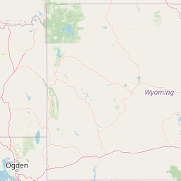
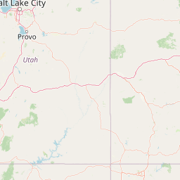
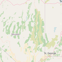
      Kaysville is located in Utah, United States within 41° 1' 44.4" N -112° 3' 15.84" W (41.0290, -111.9456) coordinates. The local time in Kaysville is 14:02 (12.04.2025)

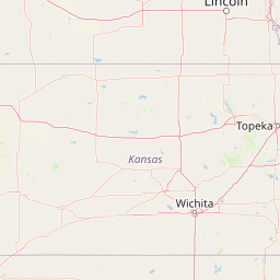
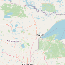
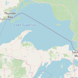
      Crystal Lake is located in Illinois, United States within 42° 13' 59.88" N -89° 39' 53.64" W (42.2333, -88.3351) coordinates. The local time in Crystal Lake is 15:02 (12.04.2025)

      The calculated flying distance from Crystal Lake to Crystal Lake is 1,218.24 miles which is equal to 1,960.57 km.

      If you want to go by car, the driving driving distance between Kaysville and Crystal Lake is 1377.02 miles (2216.10 km). If you ride your car with an average speed of 112 km/h (70 miles/h), travel time will be 19 hours 47 minutes. Please check the avg. speed travel time on the right for various options.

      Estimated Travel Time Between Kaysville and Crystal Lake

      Average speedTravel Time
      30 mph (48 km/h)45 hours 54 minutes
      40 mph (64 km/h)34 hours 26 minutes
      50 mph (80 km/h)27 hours 32 minutes
      60 mph (67 km/h)22 hours 57 minutes
      70 mph (112 km/h)19 hours 40 minutes
      75 mph (120 km/h)18 hours 22 minutes

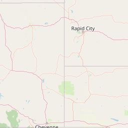
      Kaysville, Utah, United States

      Related Distances from Kaysville

      CitiesDistance
      Kaysville to San Diego (California)634.16 mi (1,020.59 km)
      Kaysville to Seattle (Washington)684.95 mi (1,102.32 km)
      Kaysville to Minneapolis (Minnesota)979.72 mi (1,576.71 km)
      Kaysville to Dallas (Texas)1,011.04 mi (1,627.11 km)
      Kaysville to St. Louis (Missouri)1,160.13 mi (1,867.05 km)
      Kaysville to Houston (Texas)1,209.85 mi (1,947.07 km)
      Kaysville to Chicago (Illinois)1,253.71 mi (2,017.64 km)
      Kaysville to Detroit (Michigan)1,483.60 mi (2,387.63 km)
      Kaysville to Atlanta (Georgia)1,584.23 mi (2,549.58 km)
      Kaysville to Washington (District of Columbia)1,843.12 mi (2,966.21 km)
      Kaysville to Baltimore (Maryland)1,856.50 mi (2,987.75 km)
      Kaysville to Tampa (Florida)1,892.67 mi (3,045.96 km)
      Kaysville to Philadelphia (Pennsylvania)1,920.39 mi (3,090.57 km)
      Kaysville to Brooklyn (New York)1,970.37 mi (3,171.00 km)
      Kaysville to New York (New York)1,970.92 mi (3,171.89 km)
      Kaysville to Queens (New York)1,976.53 mi (3,180.91 km)
      Kaysville to Boston (Massachusetts)2,090.23 mi (3,363.90 km)
      Kaysville to Miami (Florida)2,094.68 mi (3,371.05 km)
      Kaysville to Las Vegas (Nevada)376.62 mi (606.11 km)
      Kaysville to Denver (Colorado)382.06 mi (614.86 km)
      Kaysville to Phoenix (Arizona)515.28 mi (829.26 km)
      Kaysville to Riverside (California)573.55 mi (923.04 km)
      Kaysville to Los Angeles (California)594.13 mi (956.16 km)
      Kaysville to San Francisco (California)604.02 mi (972.07 km)
      Kaysville to Portland (Oregon)621.26 mi (999.82 km)

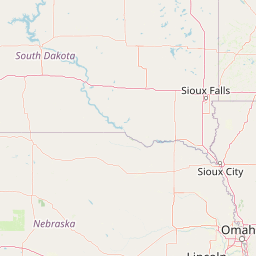
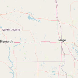
      Crystal Lake, Illinois, United States

      Related Distances to Crystal Lake

      CitiesDistance
      Atlanta (Georgia) to Crystal Lake622.64 mi (1,002.04 km)
      Washington (District of Columbia) to Crystal Lake636.40 mi (1,024.18 km)
      Baltimore (Maryland) to Crystal Lake645.19 mi (1,038.33 km)
      Philadelphia (Pennsylvania) to Crystal Lake703.34 mi (1,131.91 km)
      Brooklyn (New York) to Crystal Lake752.15 mi (1,210.46 km)
      New York (New York) to Crystal Lake752.72 mi (1,211.39 km)
      Queens (New York) to Crystal Lake758.38 mi (1,220.50 km)
      Dallas (Texas) to Crystal Lake798.41 mi (1,284.91 km)
      Denver (Colorado) to Crystal Lake877.81 mi (1,412.69 km)
      Boston (Massachusetts) to Crystal Lake880.37 mi (1,416.82 km)
      Houston (Texas) to Crystal Lake945.20 mi (1,521.15 km)
      Tampa (Florida) to Crystal Lake1,037.91 mi (1,670.35 km)
      Miami (Florida) to Crystal Lake1,226.63 mi (1,974.07 km)
      Phoenix (Arizona) to Crystal Lake1,420.23 mi (2,285.64 km)
      Las Vegas (Nevada) to Crystal Lake1,492.62 mi (2,402.15 km)
      Riverside (California) to Crystal Lake1,671.21 mi (2,689.54 km)
      Seattle (Washington) to Crystal Lake1,689.42 mi (2,718.86 km)
      San Diego (California) to Crystal Lake1,695.48 mi (2,728.62 km)
      Portland (Oregon) to Crystal Lake1,710.72 mi (2,753.14 km)
      Los Angeles (California) to Crystal Lake1,716.46 mi (2,762.37 km)
      San Francisco (California) to Crystal Lake1,819.36 mi (2,927.97 km)
      Chicago (Illinois) to Crystal Lake43.07 mi (69.32 km)
      Detroit (Michigan) to Crystal Lake267.53 mi (430.55 km)
      St. Louis (Missouri) to Crystal Lake268.07 mi (431.41 km)
      Minneapolis (Minnesota) to Crystal Lake310.55 mi (499.78 km)