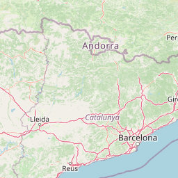
| Head south on Carrer de Rafael Casanova | 100 m |
| Turn right onto Carrer del Molí | 90 m |
| Turn left to stay on Carrer del Molí | 20 m |
| Turn left onto Passeig del Terraplè | 200 m |
| Turn right onto Carrer del Doctor Barraquer | 100 m |
| Turn right onto Avinguda de Caldes (C-1413a) | 20 m |
| Take the ramp on the left | 600 m |
| Merge left onto B-23 | 2.5 km |
| Keep right towards AP-7: Girona | 1.5 km |
| Merge left onto Autopista de la Mediterrània (AP-7) | 2.5 km |
| Take the ramp towards B-30: Barcelona | 4.5 km |
| Take exit 154A towards C-16: Rubí nord | 400 m |
| Merge left onto C-16 | 8 km |
| Keep left towards C-16: Manresa | 20 km |
| Merge right onto Autopista Barcelona-Manresa (C-16) | 15 km |
| Continue onto Eix del Llobregat (C-16) | 70 km |
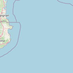
| Take the ramp onto C-162 | 3 km |
| Enter the traffic circle and take the 2nd exit onto C-162 | 50 m |
| Exit the traffic circle onto C-162 | 3 km |
| Enter the traffic circle and take the 2nd exit onto C-162 | 40 m |
| Exit the traffic circle onto C-162 | 5 km |
| Continue onto Eix Pirinenc (N-260) | 3 km |
| Enter Plaça dels Països Catalans and take the 1st exit onto N-152 | 20 m |
| Exit the traffic circle onto N-152 | 400 m |
| Enter Plaça de Sant Martí del Canigó and take the 3rd exit onto N-152 | 50 m |
| Exit the traffic circle onto N-152 | 900 m |
| Enter the traffic circle and take the 1st exit onto N-152 | 8 m |
| Exit the traffic circle onto N-152 | 60 m |
| Enter the traffic circle and take the 2nd exit | 20 m |
| Exit the traffic circle | 7 m |
| Continue onto N-154 | 1.5 km |
| Continue onto Route Neutre (N 20) | 300 m |
| Enter the traffic circle and take the 2nd exit onto N 20 | 60 m |
| Exit the traffic circle onto N 20 | 150 m |
| Enter the traffic circle and take the 1st exit onto N 20 | 20 m |
| Exit the traffic circle onto N 20 | 20 km |
| Keep right onto N 20 | 6 km |
| Make a slight left | 70 m |
| Enter the traffic circle and take the 1st exit | 40 m |
| Exit the traffic circle | 20 m |
| Go straight onto N 20 | 15 km |
| Enter the traffic circle and take the 2nd exit onto N 20 | 40 m |
| Exit the traffic circle onto N 20 | 15 km |
| Go straight onto N 20 | 10 km |
| Enter Rond-Point de Sabart and take the 2nd exit onto Avenue de Sabart (N 20) | 50 m |
| Exit the traffic circle onto Avenue de Sabart (N 20) | 700 m |
| Continue onto Avenue Saint-Roch (N 20) | 200 m |
| Make a slight right onto N 20 | 600 m |
| Turn left onto Route de Saurat (N 20) | 400 m |
| Continue onto Route de Saint Girons (N 20) | 300 m |
| Enter the traffic circle and take the 1st exit onto N 20 | 40 m |
| Exit the traffic circle onto N 20 | 35 km |
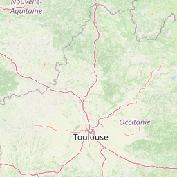
| Keep left onto L'Ariégeoise (A 66) | 35 km |
| Keep left towards A 61: Toulouse | 1.5 km |
| Merge left onto Autoroute des Deux Mers (A 61) | 20 km |
| Keep left towards A 620: Le Palays | 9 km |
| Take the ramp towards E 80: Foix | 900 m |
| Continue onto La Pyrénéenne (A 64) | 1 km |
| Take the ramp onto Saint-Simon | 350 m |
| Go straight onto Avenue du Général Eisenhower (M 120a) | 150 m |
| Enter Rond-Point Léon Lajaunie and take the 1st exit onto Avenue du Général Eisenhower (M 120a) | 70 m |
| Exit the traffic circle onto Avenue du Général Eisenhower (M 120a) | 1.5 km |
| Keep right onto Avenue du Général Eisenhower | 1 km |
| Enter Rond-Point Firmin Pons and take the 2nd exit towards BLAGNAC | 150 m |
| Exit the traffic circle towards BLAGNAC | 1 km |
| Take exit 980.3 towards Parc d'Activités De BASSO-CAMBO | 250 m |
| Enter Rond-Point Alex Jany and take the 3rd exit towards Cugnaux | 100 m |
| Exit the traffic circle towards Cugnaux | 100 m |
| Enter Rond-Point du Général Eisenhower and take the 1st exit onto Avenue du Docteur Maurice Grynfogel | 35 m |
| Exit the traffic circle onto Avenue du Docteur Maurice Grynfogel | 250 m |
| Enter the traffic circle and take the 3rd exit towards Tournefeuille | 80 m |
| Exit the traffic circle towards Tournefeuille | 800 m |
| Enter Rond-Point Henry Dunant and take the 3rd exit onto Avenue du Marquisat (M 50) | 80 m |
| Exit the traffic circle onto Avenue du Marquisat (M 50) | 400 m |
| Enter the traffic circle and take the 2nd exit onto Avenue du Marquisat (M 50) | 25 m |
| Exit the traffic circle onto Avenue du Marquisat (M 50) | 1.5 km |
| Enter Rond-Point du Serment de Koufra and take the 2nd exit onto Avenue du Marquisat (M 50) | 80 m |
| Exit the traffic circle onto Avenue du Marquisat (M 50) | 800 m |
| Go straight onto Route des Vitarelles (M 50) | 1 km |
| Enter the traffic circle and take the 2nd exit onto Route des Vitarelles (D 50) | 30 m |
| Exit the traffic circle onto Route des Vitarelles (D 50) | 200 m |
| Enter the traffic circle and take the 1st exit onto Rue Alphonse Daudet | 15 m |
| Exit the traffic circle onto Rue Alphonse Daudet | 300 m |
| Turn left onto Avenue Marcel Pagnol | 150 m |
| Enter the traffic circle and take the 1st exit onto Avenue Montaigne | 35 m |
| Exit the traffic circle onto Avenue Montaigne | 350 m |
| Continue onto Avenue Lingfield | 300 m |
| Enter the traffic circle and take the 2nd exit onto Rue du 19 Mars 1962 | 25 m |
| Exit the traffic circle onto Rue du 19 Mars 1962 | 90 m |
| Turn left onto Avenue des Pyrénées (D 632) | 60 m |
| Turn right onto Rue de la Palanque | 15 m |
| You have arrived at your destination | 0 m |