A 2, Autoroute de Wallonie

541.7 km, 5 h 39 min

Head northeast on Nottstraße500 m
Turn right onto Steinhofstraße (K 6)40 m
Turn right onto Eilsener Straße (K 11)2 km
Enter the traffic circle and take the 2nd exit onto Eilsener Straße (K 11)60 m
Exit the traffic circle onto Eilsener Straße (K 11)200 m
Continue onto Obernkirchener Straße (K 11)1 km
Turn left onto Bückeburger Straße (L 451)1.5 km
Continue onto Eilser Straße (L 451)200 m
Turn left onto Bückeburger Straße (B 83)1 km
Take the ramp on the right towards A 2: Hannover200 m
Keep right towards A 2: Dortmund600 m
Merge left onto A 2150 km
Take the ramp towards A 1: Köln350 m
Keep left towards A 1: Köln1 km
Merge left onto A 1100 km
Take the ramp90 m
Keep right towards A 4: Aachen550 m
Merge left onto A 450 km
Take the ramp towards A 44: Brüssel350 m
Keep left towards A 44: Brüssel400 m
Keep right towards A 44: Brüssel450 m
Keep left towards A 44: Brüssel200 m
Merge left onto A 4410 km
Continue onto König Baudouin Autobahn - Autoroute Roi Baudouin (E40)10 km
Continue onto Autoroute Roi Baudouin (E40)40 km
Take the ramp on the left towards Namur100 km
Keep left onto Autoroute de Wallonie (E19)25 km
Keep left towards Paris7 km
Continue onto E19300 m
Continue onto A 220 km
Keep left onto A 210 km
Keep right towards Douai3.5 km
Take the ramp towards Escaudain400 m
Turn right onto Rue Paul Bert (D 81)200 m
Enter the traffic circle and take the 3rd exit onto D 64570 m
Exit the traffic circle onto D 645400 m
Enter the traffic circle and take the 3rd exit onto D 64560 m
Exit the traffic circle onto D 6454 km
Enter the traffic circle and take the 2nd exit onto D 64535 m
Exit the traffic circle onto D 6452.5 km
Go straight onto Rue Henri Barbusse (D 47)450 m
Turn right onto Rue Adolphe Patoux (D 47)100 m
Turn left onto Rue d'Alsace150 m
Turn left onto Rue Jules Domisse90 m
Turn left to stay on Rue Jules Domisse40 m
You have arrived at your destination, on the right0 m
From
    To

      Distance: 286.48 mi (461.04 km)

      Driving route: 336.57 mi (541.65 km)

      Driving time: 5h 38 minutes

      Distance from Obernkirchen to Aniche

      The shortest distance (air line) between Obernkirchen and Aniche is 286.48 mi (461.04 km).

      The shortest route between Obernkirchen and Aniche is 336.57 mi (541.65 km) according to the route planner. The driving time is approx. 5 h 38 m.

      How far is Obernkirchen from Aniche

      Obernkirchen is located in Schaumburg, Germany within 52° 15' 59.04" N 9° 7' 4.08" E (52.2664, 9.1178) coordinates. The local time in Obernkirchen is 21:52 (08.03.2025)

      Aniche is located in Nord, France within 50° 19' 48" N 3° 15' 3.96" E (50.3300, 3.2511) coordinates. The local time in Aniche is 21:52 (08.03.2025)

      The calculated flying distance from Aniche to Aniche is 286.48 miles which is equal to 461.04 km.

      If you want to go by car, the driving driving distance between Obernkirchen and Aniche is 336.57 miles (541.65 km). If you ride your car with an average speed of 112 km/h (70 miles/h), travel time will be 4 hours 50 minutes. Please check the avg. speed travel time on the right for various options.

      Estimated Travel Time Between Obernkirchen and Aniche

      Average speedTravel Time
      30 mph (48 km/h)11 hours 13 minutes
      40 mph (64 km/h)8 hours 25 minutes
      50 mph (80 km/h)6 hours 44 minutes
      60 mph (67 km/h)5 hours 37 minutes
      70 mph (112 km/h)4 hours 48 minutes
      75 mph (120 km/h)4 hours 29 minutes

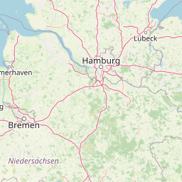
      Obernkirchen, Schaumburg, Germany

      Related Distances from Obernkirchen

      CitiesDistance
      Obernkirchen to Hannover26.23 mi (42.21 km)
      Obernkirchen to Bielefeld29.98 mi (48.24 km)
      Obernkirchen to Bremen57.99 mi (93.33 km)
      Obernkirchen to Munster66.70 mi (107.35 km)
      Obernkirchen to Dortmund87.40 mi (140.66 km)
      Obernkirchen to Hamburg96.00 mi (154.50 km)
      Obernkirchen to Bochum97.57 mi (157.02 km)
      Obernkirchen to Gelsenkirchen100.42 mi (161.62 km)
      Obernkirchen to Essen106.02 mi (170.62 km)
      Obernkirchen to Wuppertal107.76 mi (173.42 km)
      Obernkirchen to Duisburg115.78 mi (186.33 km)
      Obernkirchen to Dusseldorf122.74 mi (197.53 km)
      Obernkirchen to Cologne130.67 mi (210.29 km)
      Obernkirchen to Bonn136.93 mi (220.37 km)
      Obernkirchen to Frankfurt150.14 mi (241.63 km)
      Obernkirchen to Leipzig153.16 mi (246.49 km)
      Obernkirchen to Wiesbaden155.61 mi (250.43 km)
      Obernkirchen to Berlin181.58 mi (292.23 km)
      Obernkirchen to Mannheim194.07 mi (312.33 km)
      Obernkirchen to Nuremberg212.27 mi (341.61 km)
      Obernkirchen to Dresden215.16 mi (346.26 km)
      Obernkirchen to Karlsruhe227.21 mi (365.66 km)
      Obernkirchen to Stuttgart241.08 mi (387.97 km)
      Obernkirchen to Augsburg280.48 mi (451.40 km)
      Obernkirchen to Munich305.23 mi (491.22 km)

      Aniche, Nord, France

      Related Distances to Aniche

      CitiesDistance
      Lille to Aniche22.25 mi (35.81 km)
      Reims to Aniche81.60 mi (131.32 km)
      Paris to Aniche109.46 mi (176.17 km)
      Boulogne-Billancourt to Aniche112.76 mi (181.47 km)
      Le Havre to Aniche151.73 mi (244.19 km)
      Le Mans to Aniche211.54 mi (340.44 km)
      Dijon to Aniche223.14 mi (359.10 km)
      Strasbourg to Aniche235.13 mi (378.41 km)
      Angers to Aniche262.27 mi (422.08 km)
      Rennes to Aniche269.97 mi (434.48 km)
      Nantes to Aniche306.60 mi (493.43 km)
      Clermont-Ferrand to Aniche314.26 mi (505.75 km)
      Villeurbanne to Aniche324.13 mi (521.63 km)
      Lyon to Aniche324.15 mi (521.67 km)
      Saint-Etienne to Aniche342.32 mi (550.90 km)
      Brest to Aniche373.03 mi (600.34 km)
      Grenoble to Aniche374.39 mi (602.53 km)
      Bordeaux to Aniche419.10 mi (674.47 km)
      Nimes to Aniche451.57 mi (726.73 km)
      Montpellier to Aniche465.11 mi (748.52 km)
      Toulouse to Aniche472.39 mi (760.25 km)
      Aix-en-Provence to Aniche481.30 mi (774.57 km)
      Nice to Aniche495.20 mi (796.94 km)
      Marseille to Aniche496.14 mi (798.46 km)
      Toulon to Aniche513.59 mi (826.55 km)