


Distance from Poniatowa to Malente
The shortest distance (air line) between Poniatowa and Malente is 523.89 mi (843.11 km).
The shortest route between Poniatowa and Malente is 675.31 mi (1086.81 km) according to the route planner. The driving time is approx. 11 h 2 m.
How far is Poniatowa from Malente
Poniatowa is located in Puławski, Poland within 51° 10' 59.88" N 22° 4' 0.12" E (51.1833, 22.0667) coordinates. The local time in Poniatowa is 21:47 (08.03.2025)
Malente is located in Ostholstein, Germany within 54° 10' 0.12" N 10° 33' 0" E (54.1667, 10.5500) coordinates. The local time in Malente is 21:47 (08.03.2025)
The calculated flying distance from Malente to Malente is 523.89 miles which is equal to 843.11 km.
If you want to go by car, the driving driving distance between Poniatowa and Malente is 675.31 miles (1086.81 km). If you ride your car with an average speed of 112 km/h (70 miles/h), travel time will be 9 hours 42 minutes. Please check the avg. speed travel time on the right for various options.
Estimated Travel Time Between Poniatowa and Malente
| Average speed | Travel Time |
|---|---|
| 30 mph (48 km/h) | 22 hours 31 minutes |
| 40 mph (64 km/h) | 16 hours 53 minutes |
| 50 mph (80 km/h) | 13 hours 30 minutes |
| 60 mph (67 km/h) | 11 hours 15 minutes |
| 70 mph (112 km/h) | 9 hours 39 minutes |
| 75 mph (120 km/h) | 9 hours 0 minutes |
Related Distances from Poniatowa
| Cities | Distance |
|---|---|
| Poniatowa to Lublin | 22.12 mi (35.61 km) |
| Poniatowa to Radom | 42.16 mi (67.85 km) |
| Poniatowa to Kielce | 65.85 mi (105.97 km) |
| Poniatowa to Rzeszow | 79.51 mi (127.96 km) |
| Poniatowa to Warsaw | 85.28 mi (137.24 km) |
| Poniatowa to Lodz | 119.64 mi (192.54 km) |
| Poniatowa to Krakow | 121.33 mi (195.26 km) |
| Poniatowa to Czestochowa | 130.99 mi (210.81 km) |
| Poniatowa to Bialystok | 142.41 mi (229.18 km) |
| Poniatowa to Sosnowiec | 142.54 mi (229.40 km) |
| Poniatowa to Katowice | 147.66 mi (237.63 km) |
| Poniatowa to Bytom | 149.29 mi (240.25 km) |
| Poniatowa to Zabrze | 156.12 mi (251.24 km) |
| Poniatowa to Gliwice | 161.15 mi (259.34 km) |
| Poniatowa to Bielsko-Biala | 162.71 mi (261.85 km) |
| Poniatowa to Rybnik | 171.81 mi (276.51 km) |
| Poniatowa to Olsztyn | 191.29 mi (307.86 km) |
| Poniatowa to Torun | 194.00 mi (312.21 km) |
| Poniatowa to Wroclaw | 218.22 mi (351.19 km) |
| Poniatowa to Bydgoszcz | 218.25 mi (351.24 km) |
| Poniatowa to Poznan | 235.05 mi (378.27 km) |
| Poniatowa to Gdansk | 261.19 mi (420.35 km) |
| Poniatowa to Gdynia | 272.43 mi (438.43 km) |
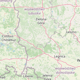
| Poniatowa to Zielona Gora | 286.70 mi (461.40 km) |
| Poniatowa to Szczecin | 353.36 mi (568.68 km) |
Related Distances to Malente
| Cities | Distance |
|---|---|
| Hamburg to Malente | 48.14 mi (77.48 km) |
| Bremen to Malente | 103.66 mi (166.82 km) |
| Hannover to Malente | 129.04 mi (207.68 km) |
| Berlin to Malente | 163.73 mi (263.49 km) |
| Bielefeld to Malente | 170.19 mi (273.89 km) |
| Munster to Malente | 194.74 mi (313.40 km) |
| Leipzig to Malente | 209.67 mi (337.43 km) |
| Dortmund to Malente | 223.74 mi (360.08 km) |
| Bochum to Malente | 231.87 mi (373.16 km) |
| Gelsenkirchen to Malente | 232.87 mi (374.77 km) |
| Essen to Malente | 238.76 mi (384.24 km) |
| Wuppertal to Malente | 244.90 mi (394.12 km) |
| Duisburg to Malente | 246.23 mi (396.27 km) |
| Dresden to Malente | 253.49 mi (407.95 km) |
| Dusseldorf to Malente | 256.73 mi (413.17 km) |
| Cologne to Malente | 269.47 mi (433.66 km) |
| Bonn to Malente | 278.10 mi (447.56 km) |
| Frankfurt to Malente | 291.20 mi (468.64 km) |
| Wiesbaden to Malente | 298.68 mi (480.68 km) |
| Nuremberg to Malente | 326.40 mi (525.29 km) |
| Mannheim to Malente | 335.27 mi (539.56 km) |
| Karlsruhe to Malente | 368.02 mi (592.27 km) |
| Stuttgart to Malente | 376.98 mi (606.69 km) |
| Augsburg to Malente | 400.87 mi (645.14 km) |
| Munich to Malente | 418.93 mi (674.20 km) |