Autoroute de l’Est, L'Ardennaise

337.8 km, 3 h 49 min

Head northeast on D 41060 m
Continue onto Boulevard Jean Jaurès350 m
Continue onto Boulevard Anatole France (D 410)700 m
Enter Place Pleyel and take the 2nd exit onto Boulevard Anatole France60 m
Exit the traffic circle onto Boulevard Anatole France150 m
Turn right onto D 41070 m
Take the ramp on the left towards A86 Bobigny400 m
Merge left onto A 863.5 km
Keep left towards Drancy7 km
Merge left onto A 3900 m
Keep left onto A 3200 m
Keep right towards Bordeaux6 km
Take the ramp towards Marne-la-Vallée350 m
Keep left towards A 4150 m
Go straight onto Pont de Nogent (N 486)200 m
Keep right towards A 5350 m
Merge left onto Autoroute de l’Est (A 4)30 km
Keep left towards A 4: Strasbourg25 km
Take the ramp on the left150 m
Merge right onto Autoroute de l’Est (A 4)70 km
Take exit 22 towards Reims-centre1.5 km
Continue onto Voie Jean Taittinger (A 344)9 km
Take the ramp towards A 34: Reims-Cormontreuil150 m
Keep left at the fork600 m
Continue onto Avenue Nicéphore Niepce1.5 km
Continue onto L'Ardennaise (A 34)80 km
Keep right onto L'Ardennaise (A 34)25 km
Keep right towards Arlon10 km
Continue onto N898 km
Continue onto N8915 km
Enter the traffic circle and take the 2nd exit onto N8950 m
Exit the traffic circle onto N891.5 km
Enter the traffic circle and take the 2nd exit onto N8950 m
Exit the traffic circle onto N894.5 km
Take the ramp towards E411550 m
Merge left onto Autoroute des Ardennes (E411)10 km
Take the ramp towards E25: Liège3 km
Merge left onto Autoroute du Soleil (E25)20 km
Take exit 53 towards N854: Clervaux350 m
Turn right onto N854900 m
Turn right onto Savy (N834)450 m
Continue onto Rue de La-Roche (N834)1 km
Enter the traffic circle and take the 2nd exit onto Rue Pierre Thomas (N30)30 m
Exit the traffic circle onto Rue Pierre Thomas (N30)100 m
Turn right onto Place Saint-Pierre (N30)80 m
Continue onto Rue du Sablon / Rue du Vivier (N30)100 m
You have arrived at your destination0 m

Autoroute du Nord, A 2

399.9 km, 4 h 16 min

Head northeast on D 41060 m
Continue onto Boulevard Jean Jaurès350 m
Continue onto Boulevard Anatole France (D 410)700 m
Enter Place Pleyel and take the 2nd exit onto Boulevard Anatole France60 m
Exit the traffic circle onto Boulevard Anatole France700 m
Make a slight right onto Rue Jules Saulnier (D 912)500 m
Make a slight right onto D 91245 m
Turn left onto Avenue du Président Wilson450 m
Turn right onto Rue Danielle Casanova150 m
Continue straight to stay on Rue Danielle Casanova200 m
Continue slightly left onto Avenue Paul Vaillant-Couturier550 m
Turn right onto Avenue Irène et Frédéric Joliot-Curie300 m
Go straight onto Route de la Courneuve (D 986)300 m
Take the ramp on the right towards A 1: Le Bourget300 m
Merge left onto Autoroute du Nord (A 1)150 km
Keep right towards A 2: Cambrai80 km
Continue onto E1935 km
Keep right towards Liège3 km
Keep left at the fork40 m
Merge left onto Autoroute de Wallonie (E42)600 m
Keep right at the fork45 m
Merge right onto Autoroute de Wallonie (E42)50 km
Take the ramp towards Bruxelles550 m
Keep left towards E411: Luxembourg900 m
Merge left onto Autoroute des Ardennes (E411)15 km
Take exit 18 towards N4: Bruxelles500 m
Keep right towards N4: Courrière700 m
Merge left onto N460 km
Take the ramp90 m
Merge left onto N410 km
Take the ramp towards E25: Liège600 m
Keep left towards E25250 m
Merge left onto Autoroute du Soleil (E25)1.5 km
Take exit 53 towards N854: Clervaux350 m
Turn right onto N854900 m
Turn right onto Savy (N834)450 m
Continue onto Rue de La-Roche (N834)1 km
Enter the traffic circle and take the 2nd exit onto Rue Pierre Thomas (N30)30 m
Exit the traffic circle onto Rue Pierre Thomas (N30)100 m
Turn right onto Place Saint-Pierre (N30)80 m
Continue onto Rue du Sablon / Rue du Vivier (N30)100 m
You have arrived at your destination0 m
From
    To

      Distance: 169.72 mi (273.14 km)

      Driving route: 209.92 mi (337.83 km)

      Driving time: 3h 49 minutes

      Distance from Saint-Ouen to Bastogne

      The shortest distance (air line) between Saint-Ouen and Bastogne is 169.72 mi (273.14 km).

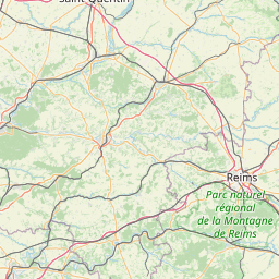
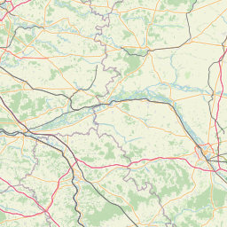
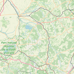
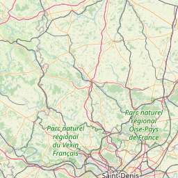
      The shortest route between Saint-Ouen and Bastogne is 209.92 mi (337.83 km) according to the route planner. The driving time is approx. 3 h 49 m.

      How far is Saint-Ouen from Bastogne

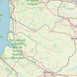
      Saint-Ouen is located in Seine-Saint-Denis, France within 48° 54' 44.28" N 2° 20' 3.12" E (48.9123, 2.3342) coordinates. The local time in Saint-Ouen is 06:22 (16.04.2025)

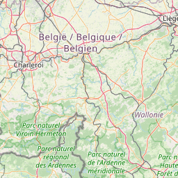
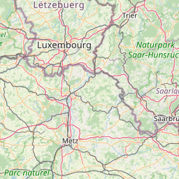
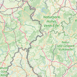
      Bastogne is located in Arr. Bastogne, Belgium within 50° 0' 15.12" N 5° 43' 12" E (50.0042, 5.7200) coordinates. The local time in Bastogne is 06:22 (16.04.2025)

      The calculated flying distance from Bastogne to Bastogne is 169.72 miles which is equal to 273.14 km.

      If you want to go by car, the driving driving distance between Saint-Ouen and Bastogne is 209.92 miles (337.83 km). If you ride your car with an average speed of 112 km/h (70 miles/h), travel time will be 3 hours 1 minutes. Please check the avg. speed travel time on the right for various options.

      Estimated Travel Time Between Saint-Ouen and Bastogne

      Average speedTravel Time
      30 mph (48 km/h)6 hours 60 minutes
      40 mph (64 km/h)5 hours 15 minutes
      50 mph (80 km/h)4 hours 12 minutes
      60 mph (67 km/h)3 hours 30 minutes
      70 mph (112 km/h)2 hours 60 minutes
      75 mph (120 km/h)2 hours 48 minutes

      Saint-Ouen, Seine-Saint-Denis, France

      Related Distances from Saint-Ouen

      CitiesDistance
      Saint-Ouen to Paris3.93 mi (6.32 km)
      Saint-Ouen to Boulogne-Billancourt6.81 mi (10.96 km)
      Saint-Ouen to Reims80.67 mi (129.82 km)
      Saint-Ouen to Le Havre108.47 mi (174.57 km)
      Saint-Ouen to Le Mans116.11 mi (186.86 km)
      Saint-Ouen to Lille122.85 mi (197.71 km)
      Saint-Ouen to Dijon165.71 mi (266.69 km)
      Saint-Ouen to Angers166.05 mi (267.24 km)
      Saint-Ouen to Rennes191.76 mi (308.62 km)
      Saint-Ouen to Nantes214.24 mi (344.78 km)
      Saint-Ouen to Clermont-Ferrand219.02 mi (352.48 km)
      Saint-Ouen to Lyon247.36 mi (398.09 km)
      Saint-Ouen to Strasbourg247.54 mi (398.37 km)
      Saint-Ouen to Villeurbanne247.85 mi (398.88 km)
      Saint-Ouen to Saint-Etienne258.93 mi (416.71 km)
      Saint-Ouen to Grenoble303.66 mi (488.69 km)
      Saint-Ouen to Bordeaux313.17 mi (504.00 km)
      Saint-Ouen to Brest313.47 mi (504.48 km)
      Saint-Ouen to Nimes363.63 mi (585.21 km)
      Saint-Ouen to Toulouse369.18 mi (594.14 km)
      Saint-Ouen to Montpellier373.54 mi (601.16 km)
      Saint-Ouen to Aix-en-Provence400.67 mi (644.81 km)
      Saint-Ouen to Marseille414.29 mi (666.74 km)
      Saint-Ouen to Nice429.84 mi (691.76 km)
      Saint-Ouen to Toulon435.33 mi (700.59 km)

      Bastogne, Arr. Bastogne, Belgium

      Related Distances to Bastogne

      CitiesDistance
      Liege to Bastogne44.40 mi (71.46 km)
      Namur to Bastogne49.43 mi (79.55 km)
      Charleroi to Bastogne63.13 mi (101.60 km)
      Leuven to Bastogne75.52 mi (121.54 km)
      Etterbeek to Bastogne82.12 mi (132.16 km)
      Sint-Joost-ten-Node to Bastogne82.92 mi (133.45 km)
      Forest to Bastogne83.05 mi (133.66 km)
      Evere to Bastogne83.22 mi (133.93 km)
      Anderlecht to Bastogne83.71 mi (134.72 km)
      Brussels to Bastogne83.73 mi (134.76 km)
      Moortebeek to Bastogne84.55 mi (136.08 km)
      Laeken to Bastogne85.13 mi (137.00 km)
      Jette to Bastogne85.29 mi (137.27 km)
      Koekelberg to Bastogne85.29 mi (137.27 km)
      Vilvoorde to Bastogne85.56 mi (137.70 km)
      Mechelen to Bastogne89.25 mi (143.64 km)
      Wilrijk to Bastogne99.45 mi (160.04 km)
      Berchem to Bastogne99.52 mi (160.16 km)
      Hoboken to Bastogne99.88 mi (160.74 km)
      Borgerhout to Bastogne100.53 mi (161.79 km)
      Deurne to Bastogne100.75 mi (162.14 km)
      Antwerp to Bastogne101.87 mi (163.95 km)
      Merksem to Bastogne102.29 mi (164.63 km)
      Gent to Bastogne113.72 mi (183.01 km)
      Bruges to Bastogne137.48 mi (221.26 km)