| Head southwest on Sunninghill Road (B3020) | 150 m |
| Continue onto High Street (B3020) | 200 m |
| Continue onto Bagshot Road (B3020) | 450 m |
| Continue straight onto Bagshot Road (B3020) | 1.5 km |
| Continue onto Sunninghill Road (B3020) | 800 m |
| Turn right onto London Road (A30) | 600 m |
| Continue onto Hallgrove Bottom (A30) | 350 m |
| Enter the traffic circle and take the 1st exit onto Grove End | 6 m |
| Exit the traffic circle onto Grove End | 700 m |
| Merge right onto Bagshot Bypass (A322) | 1.5 km |
| Take the ramp on the left onto M3 | 7 km |
| Take the ramp on the left onto M3 | 600 m |
| Keep right at the fork | 80 m |
| Keep left onto A331 | 10 km |
| Take the ramp on the left towards A31 | 550 m |
| Merge right onto A31 | 2 km |
| Take the ramp on the left onto A31 | 350 m |
| Merge right onto Farnham Bypass (A31) | 3 km |
| Enter Coxbridge Roundabout and take the 1st exit onto Wrecclesham Road (A325) | 20 m |
| Exit the traffic circle onto Wrecclesham Road (A325) | 800 m |
| Turn right onto The Street (A325) | 500 m |
| Continue onto Wrecclesham Hill (A325) | 550 m |
| Continue onto Farnham Road (A325) | 2 km |
| Continue onto Main Road (A325) | 1 km |
| Continue onto Farnham Road (A325) | 5 km |
| Enter the traffic circle and take the 2nd exit onto Louisburg Avenue (A325) | 60 m |
| Exit the traffic circle onto Louisburg Avenue (A325) | 200 m |
| Enter the traffic circle and take the 2nd exit onto Louisburg Avenue (A325) | 40 m |
| Exit the traffic circle onto Louisburg Avenue (A325) | 350 m |
| Enter the traffic circle and take the 2nd exit onto Louisburg Avenue (A325) | 30 m |
| Exit the traffic circle onto Louisburg Avenue (A325) | 3 km |
| Enter the traffic circle and take the 3rd exit onto Petersfield Road (A325) | 100 m |
| Exit the traffic circle onto Petersfield Road (A325) | 2.5 km |
| Enter the traffic circle and take the 1st exit onto Woolmer Road (A325) | 9 m |
| Exit the traffic circle onto Woolmer Road (A325) | 800 m |
| Enter the traffic circle and take the 2nd exit onto A325 | 25 m |
| Exit the traffic circle onto A325 | 200 m |
| Take the ramp on the left onto A325 | 250 m |
| Merge right onto Liphook and Petersfield Bypass (A3) | 2.5 km |
| Enter Ham Barn Roundabout and take the 2nd exit onto Liphook and Petersfield Bypass (A3) | 70 m |
| Exit the traffic circle onto Liphook and Petersfield Bypass (A3) | 10 km |
| Continue onto London Road (A3) | 15 km |
| Continue onto A27 | 3.5 km |
| Continue onto M27 | 1 km |
| Take exit 12 on the left towards M275: Portsmouth | 900 m |
| Merge right onto M275 | 2 km |
| Take exit 2 on the left towards Cruise and Cross Channel Ferries | 500 m |
| Enter Rudmore Roundabout and take the 4th exit | 200 m |
| Exit the traffic circle | 60 m |
| Turn left | 55 m |
| Turn right | 25 m |
| Keep right at the fork | 250 m |
| Make a slight left | 350 m |
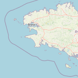
| Take the ferry Portsmouth - Cherbourg | 150 km |
| Continue straight | 100 m |
| Continue slightly left onto Sortie Portuaire | 250 m |
| Keep left onto Sortie Portuaire | 25 m |
| Keep right at the fork | 150 m |
| Go straight onto Sortie Portuaire | 800 m |
| Enter Rond-Point des Mielles and take the 2nd exit | 90 m |
| Exit the traffic circle | 60 m |
| Go straight onto Voie Portuaire | 550 m |
| Enter Rond-Point de la Pyrotechnie and take the 1st exit onto Rue Aristide Briand | 15 m |
| Exit the traffic circle onto Rue Aristide Briand | 700 m |
| Turn left onto Rue Médéric | 200 m |
| Continue onto Rue Gambetta | 400 m |
| Turn right onto Avenue des Prairies | 700 m |
| Enter Rond-Point de Penesme and take the 2nd exit onto Axe Nord-Sud (N 13) | 50 m |
| Exit the traffic circle onto Axe Nord-Sud (N 13) | 4.5 km |
| Enter Rond-Point André Malraux and take the 3rd exit onto N 13 | 150 m |
| Exit the traffic circle onto N 13 | 100 km |
| Continue onto Périphérique Nord (N 814) | 9 km |
| Continue onto Périphérique Nord (N 814) | 1.5 km |
| Take the ramp towards Deauville-Trouville | 450 m |
| Keep left towards A 13: Deauville-Trouville | 200 km |
| Keep right towards Versailles | 15 km |
| Take the ramp towards A 86: Créteil | 200 m |
| Continue straight | 600 m |
| Keep right at the fork | 500 m |
| Merge left onto Duplex A86 (A 86) | 10 km |
| Continue onto N 385 | 6 km |
| Continue onto A 86 | 3 km |
| Take the ramp towards A 6 B: Bordeaux | 600 m |
| Merge left onto A 6b | 1.5 km |
| Take the ramp on the left towards A 6: Évry | 600 m |
| Merge left onto Autoroute du Soleil (A 6) | 15 km |
| Keep left onto Autoroute du Soleil (A 6) | 3.5 km |
| Take exit 8 towards N 104: Troyes | 350 m |
| Merge right onto La Francilienne (N 104) | 5.5 km |
| Take exit 29 towards D 448: Soisy s/ Seine | 350 m |
| Enter the traffic circle and take the 2nd exit onto D 448 | 35 m |
| Exit the traffic circle onto D 448 | 1.5 km |
| Turn left onto Place Saint-Léonard (D 947) | 80 m |
| Turn left onto D 947 | 900 m |
| Enter the traffic circle and take the 1st exit onto Route de Lieusaint (D 947) | 15 m |
| Exit the traffic circle onto Route de Lieusaint (D 947) | 250 m |
| Enter the traffic circle and take the 1st exit onto Rue de la Tuilerie | 6 m |
| Exit the traffic circle onto Rue de la Tuilerie | 450 m |
| Continue onto Rue de la Mairie | 500 m |
| Turn left onto Avenue des Jasmins | 80 m |
| You have arrived at your destination | 0 m |