


Distance from Szentendre to Beli Manastir
The shortest distance (air line) between Szentendre and Beli Manastir is 135.71 mi (218.40 km).
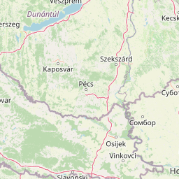
The shortest route between Szentendre and Beli Manastir is 156.58 mi (251.99 km) according to the route planner. The driving time is approx. 3 h 17 m.
How far is Szentendre from Beli Manastir
Szentendre is located in Pest, Hungary within 47° 42' 15.84" N 19° 4' 6.96" E (47.7044, 19.0686) coordinates. The local time in Szentendre is 01:12 (04.03.2025)
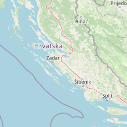
Beli Manastir is located in Osječko-baranjska županija, Croatia within 45° 46' 0.12" N 18° 36' 0" E (45.7667, 18.6000) coordinates. The local time in Beli Manastir is 01:12 (04.03.2025)
The calculated flying distance from Beli Manastir to Beli Manastir is 135.71 miles which is equal to 218.40 km.
If you want to go by car, the driving driving distance between Szentendre and Beli Manastir is 156.58 miles (251.99 km). If you ride your car with an average speed of 112 km/h (70 miles/h), travel time will be 2 hours 15 minutes. Please check the avg. speed travel time on the right for various options.
Estimated Travel Time Between Szentendre and Beli Manastir
| Average speed | Travel Time |
|---|---|
| 30 mph (48 km/h) | 5 hours 13 minutes |
| 40 mph (64 km/h) | 3 hours 55 minutes |
| 50 mph (80 km/h) | 3 hours 8 minutes |
| 60 mph (67 km/h) | 2 hours 37 minutes |
| 70 mph (112 km/h) | 2 hours 14 minutes |
| 75 mph (120 km/h) | 2 hours 5 minutes |
Related Distances from Szentendre
Beli Manastir, Osječko-baranjska županija, Croatia