| Head east on Calle de Bonifacio del Castillo Orcajo | 55 m |
| Turn right to stay on Calle de Bonifacio del Castillo Orcajo | 40 m |
| Turn right onto Calle de Casimiro Sainz | 100 m |
| Turn right onto Calle de Julián Urbina | 250 m |
| Turn left onto Calle de José María Pereda (N-611) | 700 m |
| Continue onto Calle de Joaquín Cayón (N-611) | 350 m |
| Enter the traffic circle and take the 2nd exit onto Avenida de Palencia (N-611) | 35 m |
| Exit the traffic circle onto Avenida de Palencia (N-611) | 60 m |
| Enter the traffic circle and take the 2nd exit onto Avenida de Palencia (N-611) | 40 m |
| Exit the traffic circle onto Avenida de Palencia (N-611) | 150 m |
| Enter Plaza de Clara Campoamor and take the 1st exit onto Avenida de Palencia (N-611) | 25 m |
| Exit the traffic circle onto Avenida de Palencia (N-611) | 700 m |
| Enter the traffic circle and take the 2nd exit onto Avenida de Palencia (N-611) | 55 m |
| Exit the traffic circle onto Avenida de Palencia (N-611) | 450 m |
| Enter the traffic circle and take the 2nd exit onto Avenida de Palencia (N-611) | 25 m |
| Exit the traffic circle onto Avenida de Palencia (N-611) | 30 m |
| Continue onto Calle de la Cruz (N-611) | 100 m |
| Continue onto Calle del Lugar (N-611) | 150 m |
| Enter the traffic circle and take the 2nd exit towards Cartes | 20 m |
| Exit the traffic circle towards Cartes | 550 m |
| Continue onto Calle de la Mies de Molladar (N-611) | 700 m |
| Enter the traffic circle and take the 2nd exit onto Calle de la Mies de Molladar (N-611) | 20 m |
| Exit the traffic circle onto Calle de la Mies de Molladar (N-611) | 600 m |
| Enter the traffic circle and take the 2nd exit towards A-67: Reinosa | 25 m |
| Exit the traffic circle towards A-67: Reinosa | 400 m |
| Merge left onto Autovía Cantabria - Meseta (A-67) | 8 km |
| Continue onto Túnel de Gedo (A-67) | 2.5 km |
| Continue onto Viaducto de Cieza (A-67) | 300 m |
| Continue onto Autovía Cantabria - Meseta (A-67) | 10 km |
| Continue onto Viaducto de Bárcena (A-67) | 350 m |
| Continue onto Viaducto de los Arroyos (A-67) | 450 m |
| Continue onto Autovía Cantabria - Meseta (A-67) | 150 km |
| Merge left onto Autovía de Castilla (A-62) | 60 km |
| Merge right onto Autovía del Noroeste (A-6) | 1 km |
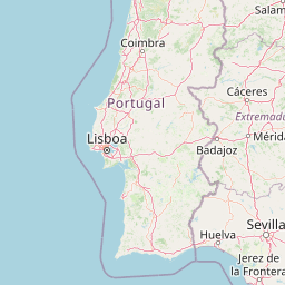
| Keep right towards A-11 Zamora | 200 km |
| Continue onto Autoestrada das Beiras Litoral e Alta (A 25) | 35 km |
| Take exit 30 on the left towards A 23: Guarda Sul | 200 km |
| Keep left towards A 1: Lisboa | 800 m |
| Merge left onto Autoestrada do Norte (A 1) | 80 km |
| Take the ramp towards A 9: Loures | 300 m |
| Merge left onto Circular Regional Exterior de Lisboa (CREL) (A 9) | 35 km |
| Take the ramp towards A 5: Cascais | 350 m |
| Merge left onto Autoestrada da Costa do Estoril (A 5) | 15 km |
| Keep right towards Malveira | 300 m |
| Go straight onto Estrada da Malveira da Serra (EN 9-1) | 400 m |
| Enter Estrada da Malveira da Serra and take the 2nd exit onto Estrada da Malveira da Serra (EN 9-1) | 30 m |
| Exit the traffic circle onto Estrada da Malveira da Serra (EN 9-1) | 550 m |
| Enter the traffic circle and take the 2nd exit onto Estrada Malveira da Serra (EN 9-1) | 15 m |
| Exit the traffic circle onto Estrada Malveira da Serra (EN 9-1) | 1.5 km |
| Continue onto Rua de Cascais (EN 9-1) | 1 km |
| Continue slightly left onto EN 247-5 | 200 m |
| Turn right onto Rua do Cabo (EN 247) | 5 km |
| Turn left onto Estrada do Cabo da Roca | 3 km |
| Turn left | 200 m |
| Turn right | 40 m |
| You have arrived at your destination | 0 m |