Autovía de las Rías Baixas, Autovía del Noroeste

429.6 km, 4 h 46 min

Head west on Rua Doutor Henrique Ferreira Botelho90 m
Continue left onto Rua Comendador Silva100 m
Turn right onto Rua Doutor António Gil200 m
Turn right onto Avenida Doutor Carlos Alberto Ferreira de Sousa150 m
Turn left onto Rua António José de Ávila (EN 206)35 m
Make a slight left onto EN 20615 m
Enter the traffic circle and take the 3rd exit onto Rua Imperador Teodósio (EN 206)35 m
Exit the traffic circle onto Rua Imperador Teodósio (EN 206)2 km
Enter the traffic circle and take the 2nd exit towards A 24: Espanha80 m
Exit the traffic circle towards A 24: Espanha400 m
Merge left onto Autoestrada do Interior Norte (A 24)45 km
Continue onto Autovía Verín-Fronteira Portuguesa (A-75)10 km
Take the ramp onto A-751 km
Merge left onto Autovía das Rías Baixas (A-52)45 km
Continue onto Autovía de las Rías Baixas (A-52)100 km
Take the ramp towards A-6: Benavente1.5 km
Merge left onto Autovía Ruta de la Plata (A-66)600 m
Merge left towards A-6: Madrid10 km
Keep left towards A-6: Tordesillas Madrid70 km
Keep left onto Autovía del Noroeste (A-6)70 km
Continue onto Autopista del Noroeste (AP-6)30 km
Take the ramp towards N-110: Villacastín800 m
Enter the traffic circle and take the 1st exit onto N-11015 m
Exit the traffic circle onto N-110400 m
Enter the traffic circle and take the 2nd exit onto N-11080 m
Exit the traffic circle onto N-110600 m
Enter the traffic circle and take the 2nd exit35 m
Exit the traffic circle300 m
Continue straight300 m
Merge left onto Carretera Madrid a A Coruña (N-6)15 km
Take the ramp towards El Espinar450 m
Enter the traffic circle and take the 1st exit onto Carretera de Segovia (SG-P-5121)20 m
Exit the traffic circle onto Carretera de Segovia (SG-P-5121)800 m
Continue onto Calle Real450 m
Turn left onto Calle Puente Ledesma40 m
Turn right onto Calle Valladolid150 m
Turn left onto Calle del Pilar30 m
Keep right onto Calle Santa Bárbara30 m
Make a slight left onto Calle Francisco San Juan60 m
Turn right onto Calle San Roque45 m
Turn right onto Calle Real2.5 m
You have arrived at your destination0 m

Autoestrada Transmontana, Autovía Ávila-Salamanca

441.9 km, 5 h 13 min

Head west on Rua Doutor Henrique Ferreira Botelho90 m
Continue left onto Rua Comendador Silva150 m
Turn left onto Avenida General Humberto Delgado200 m
Turn left onto Avenida Doutor Abílio Ribeiro (EN 2)100 m
Keep left at the fork70 m
Make a slight right onto EN 2100 m
Turn right150 m
Turn left150 m
Turn right150 m
Turn right200 m
Go straight onto Rua Alferes Duarte de Almeida (EN 212)25 km
Keep right onto ER 152 km
Make a slight right onto EN 15800 m
Enter the traffic circle and take the 1st exit towards A 4: Porto6 m
Exit the traffic circle towards A 4: Porto200 m
Merge left onto IC 5700 m
Keep left towards A 4: Bragança450 m
Merge left onto Autoestrada Transmontana (A 4)100 km
Continue onto Carretera de Zamora a Portugal (N-122)20 km
Continue onto Calle de la Herradura (N-122)550 m
Turn left onto Plaza Mayor (N-122)60 m
Continue onto Calle de San Francisco (N-122)150 m
Continue onto Carretera de Zamora (N-122)20 km
Continue onto Calle Carretera (N-122)1 km
Continue onto Carretera de Zamora a Portugal (N-122)30 km
Continue onto Autovía del Duero (N-122)600 m
Continue onto Ronda Norte de Zamora (A-11)6 km
Keep right towards A-66500 m
Merge left onto Autovía Ruta de la Plata (A-66)70 km
Merge left onto Autovía de Castilla (A-62)5 km
Take the ramp towards E-803: Caceres150 m
Keep right towards E-803: Caceres80 m
Continue onto Autovía Ruta de la Plata600 m
Enter the traffic circle and take the 1st exit towards E-803: Cáceres70 m
Exit the traffic circle towards E-803: Cáceres2.5 km
Take the ramp towards CL-512: Aldeatejada800 m
Enter the traffic circle and take the 3rd exit onto Ronda Sur de Salamanca (SA-20)200 m
Exit the traffic circle onto Ronda Sur de Salamanca (SA-20)2 km
Enter the traffic circle and take the 2nd exit onto Ronda Sur de Salamanca (SA-20)90 m
Exit the traffic circle onto Ronda Sur de Salamanca (SA-20)1 km
Enter the traffic circle and take the 2nd exit onto N-501300 m
Exit the traffic circle onto N-501300 m
Merge left onto Autovía Ávila-Salamanca (A-50)100 km
Merge left onto Circunvalación de Ávila (AV-20)5.5 km
Take the ramp towards Ávila300 m
Keep right at the fork55 m
Merge left onto N-110a700 m
Enter the traffic circle and take the 3rd exit onto Avenida de Juan Carlos I (N-110a)35 m
Exit the traffic circle onto Avenida de Juan Carlos I (N-110a)450 m
Enter the traffic circle and take the 4th exit onto Calle de Teresa de Calcuta55 m
Exit the traffic circle onto Calle de Teresa de Calcuta90 m
Enter the traffic circle and take the 2nd exit onto Calle de Teresa de Calcuta35 m
Exit the traffic circle onto Calle de Teresa de Calcuta250 m
Enter the traffic circle and take the 2nd exit onto Calle de Teresa de Calcuta40 m
Exit the traffic circle onto Calle de Teresa de Calcuta200 m
Enter the traffic circle and take the 4th exit onto Carretera de El Espinar (AV-500)70 m
Exit the traffic circle onto Carretera de El Espinar (AV-500)20 km
Continue onto SG-50015 km
Enter the traffic circle and take the 1st exit onto Carretera de Ávila (SG-500)20 m
Exit the traffic circle onto Carretera de Ávila (SG-500)1 km
Turn left onto Calle Eras Tía Catalina300 m
Turn left onto Calle del Trozo30 m
Keep right onto Calle Segovia150 m
Make a slight left onto Calle Bruno Ortega45 m
Keep right onto Calle Bruno Ortega45 m
Turn right onto Calle San Roque40 m
Turn left onto Calle Real2.5 m
You have arrived at your destination0 m
From
    To

      Distance: 184.77 mi (297.36 km)

      Driving route: 266.97 mi (429.64 km)

      Driving time: 4h 45 minutes

      Distance from Vila Pouca de Aguiar to El Espinar

      The shortest distance (air line) between Vila Pouca de Aguiar and El Espinar is 184.77 mi (297.36 km).

      The shortest route between Vila Pouca de Aguiar and El Espinar is 266.97 mi (429.64 km) according to the route planner. The driving time is approx. 4 h 45 m.

      How far is Vila Pouca de Aguiar from El Espinar

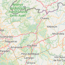
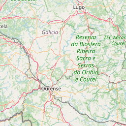
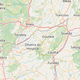
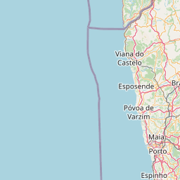
      Vila Pouca de Aguiar is located in Alto Tâmega, Portugal within 41° 30' 2.16" N -8° 21' 28.08" W (41.5006, -7.6422) coordinates. The local time in Vila Pouca de Aguiar is 01:50 (13.11.2025)

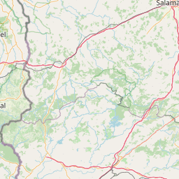
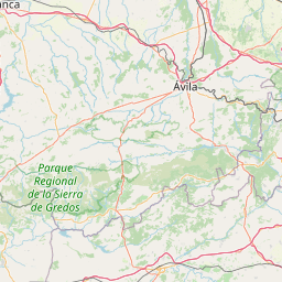
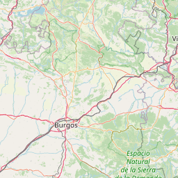
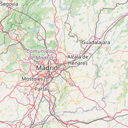
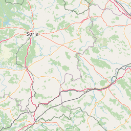
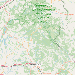
      El Espinar is located in Segovia, Spain within 40° 43' 6.96" N -5° 45' 7.92" W (40.7186, -4.2478) coordinates. The local time in El Espinar is 02:50 (13.11.2025)

      The calculated flying distance from El Espinar to El Espinar is 184.77 miles which is equal to 297.36 km.

      If you want to go by car, the driving driving distance between Vila Pouca de Aguiar and El Espinar is 266.97 miles (429.64 km). If you ride your car with an average speed of 112 km/h (70 miles/h), travel time will be 3 hours 50 minutes. Please check the avg. speed travel time on the right for various options.

      Estimated Travel Time Between Vila Pouca de Aguiar and El Espinar

      Average speedTravel Time
      30 mph (48 km/h)8 hours 54 minutes
      40 mph (64 km/h)6 hours 40 minutes
      50 mph (80 km/h)5 hours 20 minutes
      60 mph (67 km/h)4 hours 27 minutes
      70 mph (112 km/h)3 hours 49 minutes
      75 mph (120 km/h)3 hours 34 minutes

      Vila Pouca de Aguiar, Alto Tâmega, Portugal

      Related Distances from Vila Pouca de Aguiar

      CitiesDistance
      Vila Pouca de Aguiar to Funchal796.07 mi (1,281.15 km)
      Vila Pouca de Aguiar to Guimaraes34.23 mi (55.09 km)
      Vila Pouca de Aguiar to Aves34.31 mi (55.22 km)
      Vila Pouca de Aguiar to Braga40.38 mi (64.98 km)
      Vila Pouca de Aguiar to Famalicao45.65 mi (73.47 km)
      Vila Pouca de Aguiar to Barcelos50.43 mi (81.16 km)
      Vila Pouca de Aguiar to Gondomar52.20 mi (84.00 km)
      Vila Pouca de Aguiar to Maia53.80 mi (86.58 km)
      Vila Pouca de Aguiar to Porto55.96 mi (90.05 km)
      Vila Pouca de Aguiar to Vila Nova de Gaia56.58 mi (91.06 km)
      Vila Pouca de Aguiar to Matosinhos59.09 mi (95.09 km)
      Vila Pouca de Aguiar to Viseu59.36 mi (95.54 km)
      Vila Pouca de Aguiar to Viana do Castelo63.06 mi (101.49 km)
      Vila Pouca de Aguiar to Coimbra98.13 mi (157.92 km)
      Vila Pouca de Aguiar to Leiria135.33 mi (217.80 km)
      Vila Pouca de Aguiar to Loures201.09 mi (323.63 km)
      Vila Pouca de Aguiar to Odivelas204.10 mi (328.47 km)
      Vila Pouca de Aguiar to Lisbon207.64 mi (334.16 km)
      Vila Pouca de Aguiar to Sintra208.17 mi (335.02 km)
      Vila Pouca de Aguiar to Queluz208.42 mi (335.42 km)
      Vila Pouca de Aguiar to Amadora208.86 mi (336.12 km)
      Vila Pouca de Aguiar to Almada210.69 mi (339.07 km)
      Vila Pouca de Aguiar to Oeiras213.82 mi (344.11 km)
      Vila Pouca de Aguiar to Cascais215.02 mi (346.04 km)
      Vila Pouca de Aguiar to Setubal216.02 mi (347.65 km)

      El Espinar, Segovia, Spain

      Related Distances to El Espinar

      CitiesDistance
      Las Palmas to El Espinar1,076.47 mi (1,732.41 km)
      Mostoles to El Espinar33.31 mi (53.60 km)
      Madrid to El Espinar35.37 mi (56.93 km)
      Valladolid to El Espinar69.13 mi (111.25 km)
      Vitoria-Gasteiz to El Espinar167.87 mi (270.17 km)
      Zaragoza to El Espinar186.40 mi (299.98 km)
      Bilbao to El Espinar188.10 mi (302.71 km)
      Cordoba to El Espinar197.87 mi (318.44 km)
      Oviedo to El Espinar200.05 mi (321.95 km)
      Gijon to El Espinar208.22 mi (335.10 km)
      Valencia to El Espinar222.04 mi (357.34 km)
      Petrel to El Espinar240.18 mi (386.53 km)
      Granada to El Espinar247.08 mi (397.64 km)
      Murcia to El Espinar251.73 mi (405.12 km)
      Vigo to El Espinar253.62 mi (408.15 km)
      Elche to El Espinar253.95 mi (408.70 km)
      Sevilla to El Espinar257.91 mi (415.06 km)
      Alicante to El Espinar259.06 mi (416.92 km)
      Malaga to El Espinar276.47 mi (444.94 km)
      Cartagena to El Espinar277.52 mi (446.63 km)
      Tarrasa to El Espinar330.61 mi (532.06 km)
      Sabadell to El Espinar335.58 mi (540.06 km)
      Barcelona to El Espinar337.81 mi (543.65 km)
      Badalona to El Espinar341.08 mi (548.91 km)
      Palma to El Espinar372.81 mi (599.98 km)