| Head north on Carrer de Sant Jaume | 60 m |
| Turn left onto Carrer de Colom | 150 m |
| Continue onto Carrer de Gómez Arnés | 150 m |
| Turn left onto Carretera de Llíria (CV-50) | 1 km |
| Enter the traffic circle and take the 3rd exit onto CV-50 | 70 m |
| Exit the traffic circle onto CV-50 | 1 km |
| Enter the traffic circle and take the 2nd exit onto CV-50 | 60 m |
| Exit the traffic circle onto CV-50 | 1.5 km |
| Enter the traffic circle and take the 3rd exit onto Carretera de Tavernes a Llíria (CV-50) | 70 m |
| Exit the traffic circle onto Carretera de Tavernes a Llíria (CV-50) | 6 km |
| Enter the traffic circle and take the 2nd exit onto Carretera de Tavernes a Llíria (CV-50) | 35 m |
| Exit the traffic circle onto Carretera de Tavernes a Llíria (CV-50) | 400 m |
| Enter the traffic circle and take the 2nd exit onto Carretera de Tavernes a Llíria (CV-50) | 60 m |
| Exit the traffic circle onto Carretera de Tavernes a Llíria (CV-50) | 600 m |
| Enter the traffic circle and take the 2nd exit onto Carretera de Tavernes a Llíria (CV-50) | 40 m |
| Exit the traffic circle onto Carretera de Tavernes a Llíria (CV-50) | 300 m |
| Enter the traffic circle and take the 2nd exit onto Carretera de Tavernes a Llíria (CV-50) | 55 m |
| Exit the traffic circle onto Carretera de Tavernes a Llíria (CV-50) | 600 m |
| Enter the traffic circle and take the 2nd exit onto Carretera de Tavernes a Llíria (CV-50) | 70 m |
| Exit the traffic circle onto Carretera de Tavernes a Llíria (CV-50) | 1 km |
| Take the ramp on the right | 600 m |
| Merge left onto Autovía del Este / Autovia de l'Est (A-3) | 100 km |
| Continue towards A-3: Madrid | 25 km |
| Keep left towards Albacete | 200 km |
| Continue onto Autovía Ciudad Real - Puertollano (A-41) | 250 m |
| Take the ramp | 900 m |
| Enter the traffic circle and take the 1st exit | 25 m |
| Exit the traffic circle | 35 m |
| Continue slightly right onto Calle Obispo Rafael Torija | 350 m |
| Enter the traffic circle and take the 3rd exit onto Carretera de Fuensanta | 70 m |
| Exit the traffic circle onto Carretera de Fuensanta | 550 m |
| Enter the traffic circle and take the 3rd exit onto Avenida de los Reyes Católicos | 90 m |
| Exit the traffic circle onto Avenida de los Reyes Católicos | 350 m |
| Enter the traffic circle and take the 2nd exit onto Avenida de los Reyes Católicos | 100 m |
| Exit the traffic circle onto Avenida de los Reyes Católicos | 300 m |
| Enter the traffic circle and take the 3rd exit onto Avenida de los Reyes Católicos | 60 m |
| Exit the traffic circle onto Avenida de los Reyes Católicos | 300 m |
| Enter the traffic circle and take the 2nd exit onto Calle de las Magnolias | 60 m |
| Exit the traffic circle onto Calle de las Magnolias | 300 m |
| Enter the traffic circle and take the 3rd exit onto Carretera de Santa Amalia a Ciudad Real (N-430) | 45 m |
| Exit the traffic circle onto Carretera de Santa Amalia a Ciudad Real (N-430) | 30 m |
| Continue onto Carretera de Piedrabuena (N-430) | 700 m |
| Continue onto Carretera de Santa Amalia a Ciudad Real (N-430) | 900 m |
| Enter the traffic circle and take the 1st exit onto Carretera de Santa Amalia a Ciudad Real (N-430) | 30 m |
| Exit the traffic circle onto Carretera de Santa Amalia a Ciudad Real (N-430) | 25 km |
| Enter the traffic circle and take the 2nd exit onto Carretera de Santa Amalia a Ciudad Real (N-430) | 55 m |
| Exit the traffic circle onto Carretera de Santa Amalia a Ciudad Real (N-430) | 45 km |
| Continue onto Avenida Castilla la Mancha (N-430) | 600 m |
| Continue straight to stay on Avenida Castilla la Mancha (N-430) | 700 m |
| Continue onto Carretera de Santa Amalia a Ciudad Real (N-430) | 35 km |
| Keep left onto Carretera de Santa Amalia a Ciudad Real (N-430) | 70 km |
| Keep right onto Carretera de Santa Amalia a Ciudad Real (N-430) | 6 km |
| Keep right onto Carretera de Santa Amalia a Ciudad Real | 10 km |
| Enter the traffic circle and take the 3rd exit onto Carretera de Santa Amalia a Ciudad Real (N-430) | 200 m |
| Exit the traffic circle onto Carretera de Santa Amalia a Ciudad Real (N-430) | 5.5 km |
| Continue onto Carretera Nacional de Badajoz a Valencia por Almansa (N-430) | 6 km |
| Make a slight right onto Calle Hernán Cortés (EX-206) | 300 m |
| Enter the traffic circle and take the 3rd exit onto Calle Hernán Cortés (EX-206) | 45 m |
| Exit the traffic circle onto Calle Hernán Cortés (EX-206) | 250 m |
| Continue onto Calle Constitución (EX-206) | 400 m |
| Continue onto Calle Guardia Civil (EX-206) | 800 m |
| Continue onto Carretera de Cáceres a Villanueva de la Serena (EX-206) | 5 km |
| Take the ramp onto Enlace A-5 | 200 m |
| Turn left | 400 m |
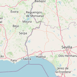
| Merge left onto A-5 | 100 km |
| Continue onto Autoestrada do Alentejo Central (A 6) | 20 km |
| Keep left onto Autoestrada do Alentejo Central (A 6) | 50 m |
| Keep right onto Autoestrada do Alentejo Central (A 6) | 150 km |
| Merge left onto Autoestrada do Sul (A 2) | 20 km |
| Take the ramp towards A 12: Lisboa Norte | 2 km |
| Merge right onto Autoestrada do Sul do Tejo (A 12) | 15 km |
| Continue towards Lisboa (Ponte Vasco da Gama) | 15 km |
| Take the ramp towards A 1: Norte | 550 m |
| Keep right towards A 1: Norte | 400 m |
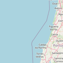
| Merge left onto Autoestrada do Norte (A 1) | 6 km |
| Take the ramp towards EN 115-5: Santa Iria | 200 m |
| Keep left towards EN 115-5: Vialonga | 70 m |
| Enter the traffic circle and take the 1st exit onto Avenida de Santa Iria (EN 115-5) | 45 m |
| Exit the traffic circle onto Avenida de Santa Iria (EN 115-5) | 400 m |
| Turn left onto Rua Alexandre Herculano | 150 m |
| Enter the traffic circle and take the 1st exit onto Rua Dom Afonso de Albuquerque | 5.5 m |
| Exit the traffic circle onto Rua Dom Afonso de Albuquerque | 800 m |
| Enter the traffic circle and take the 2nd exit onto EN 10 | 40 m |
| Exit the traffic circle onto EN 10 | 500 m |
| Enter the traffic circle and take the 2nd exit onto Avenida Marítimos da Póvoa (EN 10) | 45 m |
| Exit the traffic circle onto Avenida Marítimos da Póvoa (EN 10) | 250 m |
| Enter the traffic circle and take the 2nd exit onto Avenida Ernest Solvay | 35 m |
| Exit the traffic circle onto Avenida Ernest Solvay | 300 m |
| Enter the traffic circle and take the 1st exit onto Avenida Dom Miguel Afonso Valente | 15 m |
| Exit the traffic circle onto Avenida Dom Miguel Afonso Valente | 20 m |
| Continue onto Avenida Dom Vicente Afonso Valente | 150 m |
| Enter the traffic circle and take the 1st exit onto Avenida Dom Vicente Afonso Valente | 20 m |
| Exit the traffic circle onto Avenida Dom Vicente Afonso Valente | 250 m |
| Turn left | 100 m |
| You have arrived at your destination, on the right | 0 m |