Autoroute de Wallonie, Autoroute de Wallonie

144.3 km, 1 h 40 min

Head south on Rue du Docteur Schweitzer20 m
Turn left onto Avenue du 14 Juillet700 m
Turn left onto Rue Clemenceau (M 549)1.5 km
Continue onto Route d'Arras / Rue Clemenceau (M 549)300 m
Go straight onto Rue du Faubourg d'Arras / Route d'Arras (M 549)1 km
Continue onto Route d'Arras (M 549)350 m
Continue onto Rue du Faubourg d'Arras (M 549)350 m
Take the ramp on the right500 m
Merge left onto Boulevard Périphérique Sud (A 25)1 km
Continue onto Autoroute du Nord (A 1)900 m
Take the ramp towards A 22: Bruxelles350 m
Keep left towards Bruxelles1.5 km
Merge right onto A 22800 m
Continue towards Bruxelles900 m
Keep left towards Bruxelles10 km
Continue onto Autoroute de Wallonie (E42)10 km
Keep right onto Autoroute de Wallonie (E42)60 km
Keep right towards Liège3 km
Keep left at the fork40 m
Merge left onto Autoroute de Wallonie (E42)600 m
Keep right at the fork45 m
Merge right onto Autoroute de Wallonie (E42)45 km
Take the ramp towards Gembloux550 m
Enter the traffic circle and take the 3rd exit towards E42: Mons100 m
Exit the traffic circle towards E42: Mons700 m
Turn right onto Rue de l'Aérodrome700 m
Turn right onto Rue de Gembloux (N904)550 m
Make a sharp left onto Rue du Livot150 m
You have arrived at your destination, on the right0 m
From
    To

      Distance: 77.37 mi (124.51 km)

      Driving route: 89.69 mi (144.34 km)

      Driving time: 1h 39 minutes

      Distance from Wattignies to La Bruyere

      The shortest distance (air line) between Wattignies and La Bruyere is 77.37 mi (124.51 km).

      The shortest route between Wattignies and La Bruyere is 89.69 mi (144.34 km) according to the route planner. The driving time is approx. 1 h 39 m.

      How far is Wattignies from La Bruyere

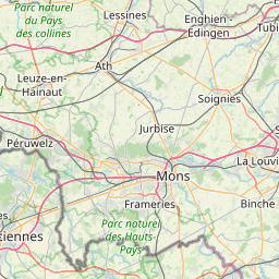
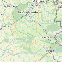
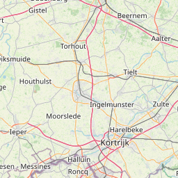
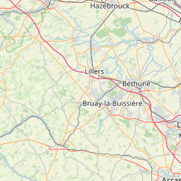
      Wattignies is located in Nord, France within 50° 35' 6" N 3° 2' 35.16" E (50.5850, 3.0431) coordinates. The local time in Wattignies is 02:55 (29.04.2025)

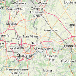
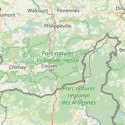
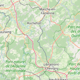
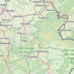
      La Bruyere is located in Arr. Namur, Belgium within 50° 30' 0" N 4° 47' 60" E (50.5000, 4.8000) coordinates. The local time in La Bruyere is 02:55 (29.04.2025)

      The calculated flying distance from La Bruyere to La Bruyere is 77.37 miles which is equal to 124.51 km.

      If you want to go by car, the driving driving distance between Wattignies and La Bruyere is 89.69 miles (144.34 km). If you ride your car with an average speed of 112 km/h (70 miles/h), travel time will be 1 hours 17 minutes. Please check the avg. speed travel time on the right for various options.

      Estimated Travel Time Between Wattignies and La Bruyere

      Average speedTravel Time
      30 mph (48 km/h)2 hours 59 minutes
      40 mph (64 km/h)2 hours 15 minutes
      50 mph (80 km/h)1 hours 48 minutes
      60 mph (67 km/h)1 hours 30 minutes
      70 mph (112 km/h)1 hours 17 minutes
      75 mph (120 km/h)1 hours 12 minutes

      Wattignies, Nord, France

      Related Distances from Wattignies

      CitiesDistance
      Wattignies to Lille3.03 mi (4.88 km)
      Wattignies to Reims101.44 mi (163.26 km)
      Wattignies to Paris123.34 mi (198.49 km)
      Wattignies to Boulogne-Billancourt126.10 mi (202.94 km)
      Wattignies to Le Havre150.92 mi (242.89 km)
      Wattignies to Le Mans219.37 mi (353.05 km)
      Wattignies to Dijon242.90 mi (390.91 km)
      Wattignies to Strasbourg251.93 mi (405.44 km)
      Wattignies to Angers269.70 mi (434.03 km)
      Wattignies to Rennes272.51 mi (438.57 km)
      Wattignies to Nantes312.43 mi (502.81 km)
      Wattignies to Clermont-Ferrand331.78 mi (533.95 km)
      Wattignies to Lyon343.47 mi (552.77 km)
      Wattignies to Villeurbanne343.48 mi (552.77 km)
      Wattignies to Saint-Etienne361.24 mi (581.36 km)
      Wattignies to Brest370.35 mi (596.01 km)
      Wattignies to Grenoble394.04 mi (634.14 km)
      Wattignies to Bordeaux431.07 mi (693.73 km)
      Wattignies to Nimes470.24 mi (756.77 km)
      Wattignies to Montpellier483.38 mi (777.93 km)
      Wattignies to Toulouse488.10 mi (785.53 km)
      Wattignies to Aix-en-Provence500.57 mi (805.60 km)
      Wattignies to Nice515.02 mi (828.84 km)
      Wattignies to Marseille515.35 mi (829.37 km)
      Wattignies to Toulon533.02 mi (857.82 km)

      La Bruyere, Arr. Namur, Belgium

      Related Distances to La Bruyere

      CitiesDistance
      Namur to La Bruyere3.73 mi (6.00 km)
      Charleroi to La Bruyere17.55 mi (28.24 km)
      Leuven to La Bruyere26.84 mi (43.20 km)
      Etterbeek to La Bruyere29.38 mi (47.29 km)
      Forest to La Bruyere30.02 mi (48.32 km)
      Sint-Joost-ten-Node to La Bruyere30.29 mi (48.75 km)
      Anderlecht to La Bruyere30.79 mi (49.55 km)
      Evere to La Bruyere30.80 mi (49.57 km)
      Brussels to La Bruyere30.95 mi (49.81 km)
      Moortebeek to La Bruyere31.76 mi (51.11 km)
      Laeken to La Bruyere32.55 mi (52.38 km)
      Jette to La Bruyere32.55 mi (52.38 km)
      Koekelberg to La Bruyere32.55 mi (52.38 km)
      Vilvoorde to La Bruyere33.83 mi (54.45 km)
      Liege to La Bruyere35.17 mi (56.60 km)
      Mechelen to La Bruyere39.05 mi (62.84 km)
      Wilrijk to La Bruyere49.52 mi (79.70 km)
      Hoboken to La Bruyere49.79 mi (80.14 km)
      Berchem to La Bruyere50.09 mi (80.61 km)
      Borgerhout to La Bruyere51.61 mi (83.06 km)
      Deurne to La Bruyere52.19 mi (83.99 km)
      Antwerp to La Bruyere52.57 mi (84.60 km)
      Merksem to La Bruyere53.65 mi (86.34 km)
      Gent to La Bruyere60.56 mi (97.46 km)
      Bruges to La Bruyere84.40 mi (135.82 km)